
Phase 01
Risk analysis
Where is the pressure?
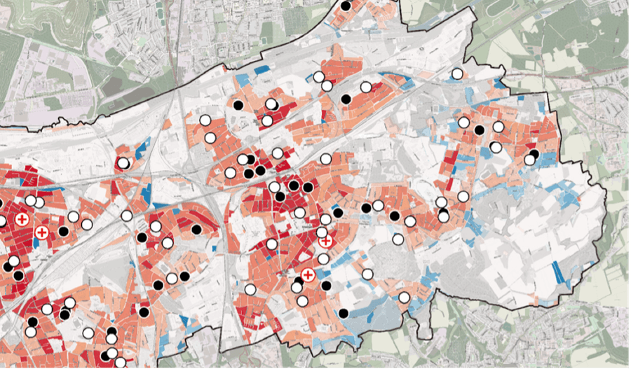
Spatial analysis of heat, heavy rainfall and drought. Hotspots become visible and target areas can be prioritised, based on public and local data.
KomAdapt is the planning software for municipal climate adaptation. It keeps analysis, measures, funding and impact in one place, documented and ready for councils, committees and funding bodies.
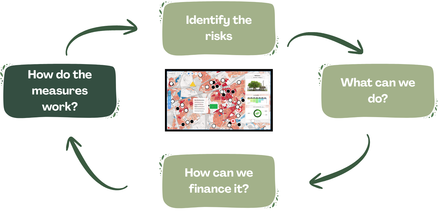
Every phase builds on the previous one. Nothing gets lost between analysis, decision and delivery, and every step remains traceable.
Spatial analysis of heat, heavy rainfall and drought. Hotspots become visible and target areas can be prioritised.
Where is the pressure?
Spatial analysis of heat, heavy rainfall and drought. Hotspots become visible and target areas can be prioritised, based on public and local data.
What can we do?
Suitable measures from established adaptation systematics and municipal practice, linked to impact, effort and responsibility.

How do we finance it?
Funding programmes, deadlines and required documents structured into one roadmap that connects to budgets and committee cycles.

What effect do the measures have?
Traceable monitoring with indicators, before and after comparisons and documentation for politics and funding bodies.

Concepts along the German adaptation strategy, from analysis and participation to a prioritised catalogue of measures.
Municipal heat action plans including vulnerability mapping, alert chains and measure packages.
Spatially explicit analyses of exposure, sensitivity and adaptive capacity as a basis for decisions.
Green roofs, de-sealing, shading, tree locations and site portfolios for sponge city measures.
Development takes place within the Grüne.Gründungen NRW initiative, co-funded by the European Union and by the Ministry of the Environment, Nature Conservation and Transport of the State of North Rhine-Westphalia. The five pilot partners are Kreis Mettmann, the City of Kaarst, the Municipality of Titz, the City of Jülich and the City of Kerpen.

Pick an open slot directly. In 30 minutes we clarify your needs, your starting point, the available data and the right path towards successful climate adaptation.
A compact exchange, no preparation needed on your side.
Always with planning, GIS and public administration expertise.
An assessment of data situation, effort and funding eligibility.